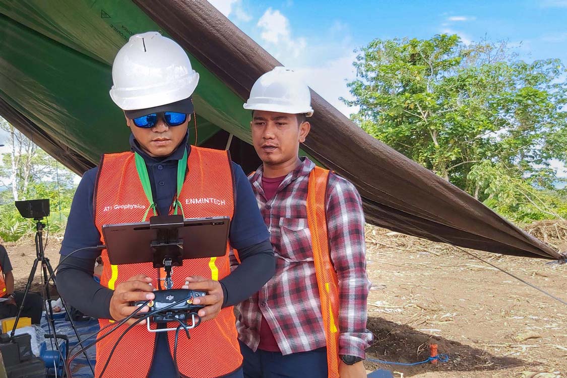
Innovative Technology, Skilled Expertise
Enmintech utilises the latest and most innovative Surveying, UAV and Geophysical technologies, combined with advanced processing and interpretation software, to deliver high quality, comprehensive results. We are flexible and adaptable with a broad range of skilled Engineers, Surveyors, Geophysicists and Geologists who can solve problems quickly and comprehensively.
Our Story
ENMINTECH started life as Energy and Mineral Technology International in 2017 with just 3 people and a small contract to do an aerial survey. On the back of those humble beginnings, the business grew from basic Aerial Surveys to encompass Geodetic and Aerial LiDAR Surveying, Geophysical Surveys, Ground Engineering, Resource and Reserve Reporting, and support for major consulting firms working on large projects.
The business expanded in 2021 with an office in Denpasar and over 30 staff and associates. ENMINTECH is IUJP certified (#073/EMT/IUJP/IX/2019) to comply with Indonesian regulations, which require that all resource sector work must be carried out by an IUJP licensed company.
Our Team

Director & Principal Surveyor
40 Years of Experience in the Exploration and Mining Sector

Chief of Business & Operations
Versatile Entrepreneur and Qualified Drone Pilot

Rifqi Ulinnuha
Senior Surveyor & UAV Manager
8 Years of Experience in Survey, Mapping, and GIS
Julian Bartlett
Principal Geologist
30 Years of Experience in Indonesia across the entire Archipelago


Our Partners
Intrepid Geophysics is a global leader in geophysical and geological software solutions, delivering cutting- edge products and expert services to the exploration and environmental sectors. With over 30 years of innovation, our flagship tools—GeoModeller for 3D geological modelling and Intrepid 3D for advanced geophysical data processing—empower geoscientists to make informed decisions across a range of applications.
Enmintech represent Inertial Labs range of LiDAR sensors in Indonesia. Inertial Labs are at the forefront of compact LiDAR systems for UAVs and their accuracy penetration and reliability is acknowledged worldwide. The RESEPI XT32 sensor emits 1.2 million pulses a second, penetrating heavy jungle precisely accurately. The PC master software processes, categorises, and filters data quickly and intuitively.
We use the powerful GSMP-35U light-weight, high sensitivity magnetometer specifically designed for UAVs. The sensors are based on GEM’s popular optically pumped Potassium Magnetometer sensor, which offers the highest sensitivity, absolute accuracy and gradient tolerance available in the industry.
Designed by MoHo in 2002, TROMINO is the first all-in-one system for the dynamic characterization of subsoils and structures and for vibration monitoring. TROMINO is continuously developed to include the latest electronic improvements, while pursuing MoHo’s philosophy of creating only ultraportable and user-friendly instruments, to make the geophysical prospection a sheer entertainment.
Business intelligence derived from drone data is only as good as the data that is used to generate it. UgCS automates our mission planning in the most challenging vertical inspection scenarios, guaranteeing high quality, reproducible data collection. The benefit is a reliable and scalable data acquisition process tailored for your industry and use case.
Global Mapper from Blue Marble Geographics is a cutting-edge GIS software that provides us with a comprehensive array of spatial data processing tools, with access to an unparalleled variety of data formats, efficient data processing, accurate map creation, and optimized spatial data management.
PT Ground Risk Management
Ground Risk Management helps us identify and mitigate risks while capitalizing on opportunities related to the ground. This involves creating concepts, scoping and managing engineering surveys, and assisting in the integration of engineering and science disciplines during the design phase.
We Care about Sustainability
At Enmintech we care about the environment and our community. We consciously limit the use of plastics and provide support to less fortunate people through a number of programs, like distributing food parcels.
Our Philosophy
We believe that the customer is the most important person in our business.
“If you don’t serve the customer, then your job is to serve someone who does” — Philip Kotler
Our Values
- Honesty
- Reliability
- Enthusiasm
- Optimism
We use reliable staff paired with reliable equipment to deliver reliable results.
Quality Surveying services in Indonesia