Mining & Exploration Projects in Indonesia
New geophysical technology combined with UAVs has improved the efficiency for discovering minerals. We can mount Photo, LiDAR, High Definition Magnetic, Radiometric, and Multispectral Imaging sensors on our drones for fast data acquisition. Land based techniques for Passive seismic HVSR, and 3D Deep IP surveys have improved markedly and are helping our geologists to find mineral deposits more quickly at a lower cost.
Mining & Exploration Services
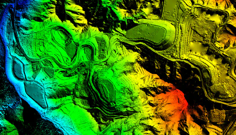
UAV LiDAR Mapping
LiDAR provides high resolution imagery and topographic surface data that is precise, clear and can highlight faults, structures and drainage patterns. This information forms the backbone for all future geophysical surveys and resource measurement.
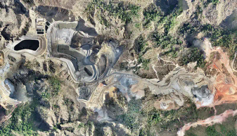
Photogrammetry Surveys
Photogrammetry uses aerial images to create precise 3D models and maps for accurate measurement and planning. Ideal for infrastructure projects, terrain analysis, and site assessments.
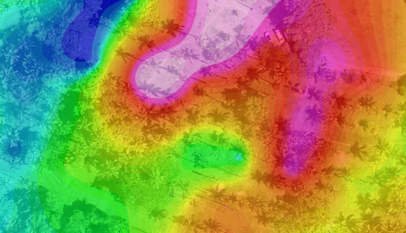
Drone High Resolution Magnetic Survey
An ultra-sensitive magnetic sensor is mounted beneath the UAV and profiles are flown at 100m AGL. The resulting data is up to 7 times clearer than traditional fixed wing magnetics providing the geologist with a clearer picture of mineralisation and structures.
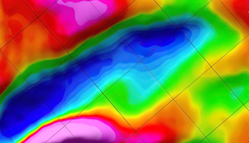
3D Deep Induced Polarisation
3D Deep IP can explore up to 800 metres below the surface to find deeply buried deposits of disseminated ores like copper and gold. This technique has been particularly successful in finding deep porphyry style deposits in Indonesia.
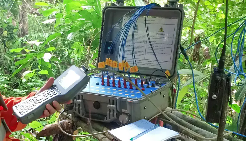
Passive Seismic HVSR
A new geophysical technique that utilises the earths background micro seismic events to identify sub surface structures. The recorded data is processed and analysed to define bedrock, faults, hydrographic features and alluvial layers. This technique is a quick and inexpensive way to check subsurface areas prior to construction of infrastructure.
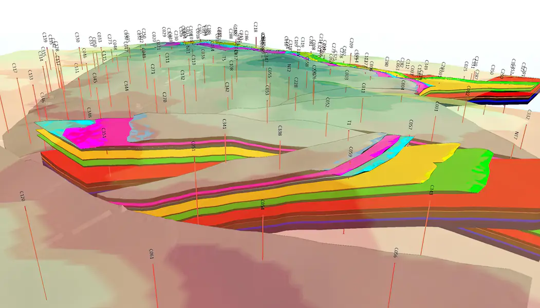
Resource Modelling & Reporting
Enmintech experts can model your resource/reserve and report to JORC, KCMI, and NI43101 standards. We have particular expertise in Tin modelling, reserve calculations, and mine design.
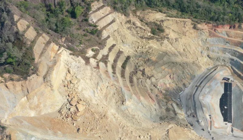
Ground Risk Management & Geotechnical
We partner with PT Ground Risk Management to provide a range of services in ground engineering for both existing and pre-feasibility mine sites. Services include: Geo-Hazard Mapping, Risk Assessments and Mitigation Advice, Geotechnical Risk Assessments, Safety Reviews and Earthworks Design Advice.
Mining & Exploration Services
UAV LiDAR Mapping
LiDAR provides high resolution imagery and topographic surface data that is precise, clear and can highlight faults, structures and drainage patterns. This information forms the backbone for all future geophysical surveys and resource measurement.
Photogrammetry Surveys
Photogrammetry uses aerial images to create precise 3D models and maps for accurate measurement and planning. Ideal for infrastructure projects, terrain analysis, and site assessments.
UAV High Definition Magnetics
An ultra-sensitive magnetic sensor is mounted beneath the UAV and profiles are flown at 100m AGL. The resulting data is up to 7 times clearer than traditional fixed wing magnetics providing the geologist with a clearer picture of mineralisation and structures.
3D Deep Induced Polarisation
3D Deep IP can explore up to 800 metres below the surface to find deeply buried deposits of disseminated ores like copper and gold. This technique has been particularly successful in finding deep porphyry style deposits in Indonesia.
Passive Seismic HVSR
A new geophysical technique that utilises the earths background micro seismic events to identify sub surface structures. The recorded data is processed and analysed to define bedrock, faults, hydrographic features and alluvial layers. This technique is a quick and inexpensive way to check subsurface areas prior to construction of infrastructure.
Resource Modelling & Reporting
Enmintech experts can model your resource/reserve and report to JORC, KCMI, and NI43101 standards. We have particular expertise in Tin modelling, reserve calculations, and mine design.
Ground Risk Management & Geotechnical
We partner with PT Ground Risk Management to provide a range of services in ground engineering for both existing and pre-feasibility mine sites. Services include: Geo-Hazard Mapping, Risk Assessments and Mitigation Advice, Geotechnical Risk Assessments, Safety Reviews and Earthworks Design Advice.
Challenges for the Mining Sector in Indonesia
Regulations
Obtaining clearances and approvals can be a time consuming and difficult process. Congestion in Jakarta and waiting times for documents and sign offs require patience and local knowledge.
Environment
Indonesia has challenging environmental conditions with steep topography, high rainfall, dense primary jungle and wild animals. Undertaking projects in these conditions requires skill toughness and persistence.
Infrastructure
Parts of Indonesia are in stages of development, and at times access to roads, electricity, and the internet can be difficult or non-existent. Enmintech is highly experienced in operating in these conditions and delivering projects successfully.
Indonesia’s Mining Industry
2.71 Billion AUD
of foreign direct investment in the Indonesian mining sector in 2020
668 Million Tons
22 Mine Prospects
Global Number 1
Papua’s Grasberg mine has the largest reserve of gold and the second largest of copper
Project Process

Project Planning
As part of our process staff personally engage with your team to discuss the project and the objectives. We then assemble the best team of expertise and technology to deliver a solution that meets expectations, on time, on budget.
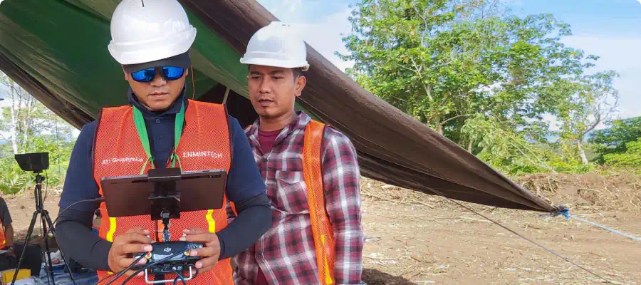
Project Execution
Our state-of-the art equipment is complex in nature and requires a deep understanding to be operated efficiently for getting best results. Our team of seasoned UAV pilots and expert surveyors from Indonesia and abroad are experienced in planning and executing challenging missions in dense jungles, steep terrain, or nearby airports.
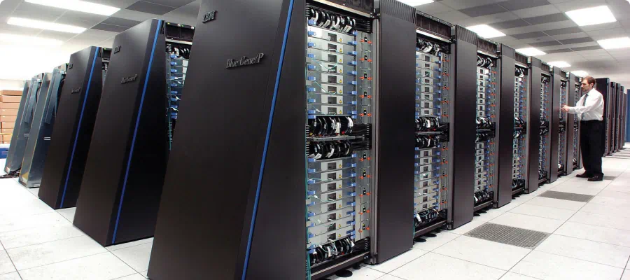
Data Processing
After acquiring the data in the field, we first validate it before we upload it to our high-speed computer processing centre. The data is then integrated into specialized software to be further processed to provide client-specific outputs.
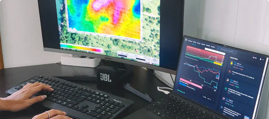
Data Analysis
Our experienced geophysical analysts not only carefully validate, process, and analyze the acquired data, but interpret and present it in clear, holistic, and transparent reports that are easy to understand so you can confidently make the right decisions.
What You can Expect from Enmintech
Comprehensive Turnkey Solutions for Your Entire Project
Professional Project Management and Execution
Dedicated Service focused on Results and Your Success
Experienced Team of Indonesian and Foreign Experts
State of the Art Technology and Survey Equipment
Outstanding Quality for a Reasonable Price
Quality Mining & Exploration Services in Indonesia