- Industries
- Construction & Land
Construction & Land Development Projects in Indonesia
Enmintech provides the complete range of land surveying services to aid construction projects, using the latest technology and expertise. Boundary checks, contour surveys, control point establishment, and subsurface surveys are routinely performed to check your land prior to purchase and construction.
Construction & Land Development Services
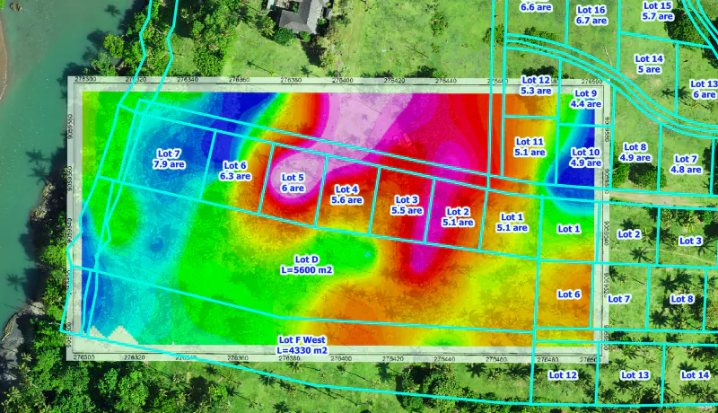
Land Surveys
Land surveying is extremely important when you plan to purchase, sub-divide or improve your existing land. Enmintech can provide a variety of land surveying services in Bali, Nusa Penida and islands throughout the Indonesian archipelago, to ensure you have the right advice and information to make decisions.
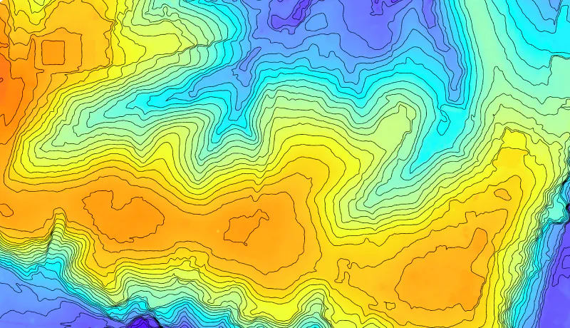
Contour & Aerial Surveys
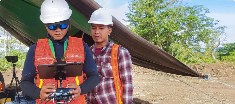
This is required for house designs, additions or for developments that need a builder or architect. The UAV survey indicates where trees, features, surface levels, visible services, contours, and the house are physically located. The land is photographed and Lidar surveyed to provide an accurate 3 dimensional Digital Surface Model. 360° photos are taken from the land at 1st and 2nd floor heights to assist in house design.
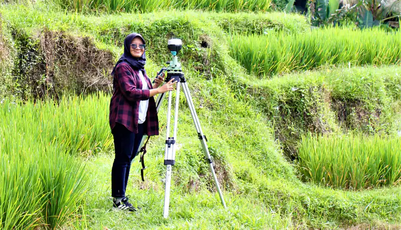
Boundary Check & Re-Peg Surveys
The corner boundaries of the property are surveyed using high accuracy GNNS receivers coordinated to the national BIG network. The results are then checked at the National Survey Office (BPN) to ensure agreement with the registered title. Our surveyor will interview neighboring landowners to check if there are disputes over ownership, right of way or other matters.
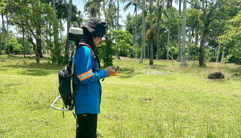
Subsurface Surveys
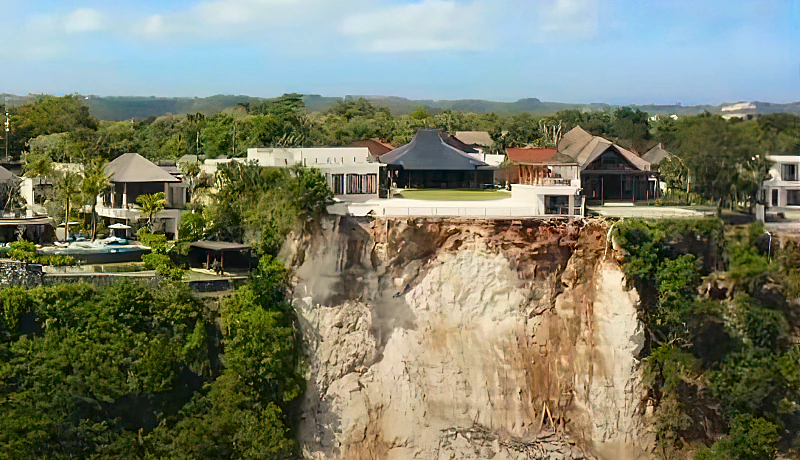
Indonesia is highly seismic, and it is wise to check if the land is stable or prone to landslides. A subsurface survey will check the depth to bedrock and identify any voids or aquifers and other features below the surface. A plan is generated highlighting areas that are susceptible to earthquake damage. This is invaluable when designing your dwelling.
Ground Risk Management & Geotechnical
We partner with PT Ground Risk Management to provide a range of services in ground engineering for both existing and pre-feasibility mine sites. Services include: Geo-Hazard Mapping, Risk Assessments and Mitigation Advice, Geotechnical Risk Assessments, Safety Reviews and Earthworks Design Advice.
Construction & Land Development Services
Land Surveys
Land surveying is extremely important when you plan to purchase, sub-divide or improve your existing land. Enmintech can provide a variety of land surveying services in Bali, Nusa Penida and islands throughout the Indonesian archipelago, to ensure you have the right advice and information to make decisions.
Contour & Aerial Surveys
This is required for house designs, additions or for developments that need a builder or architect. The UAV survey indicates where trees, features, surface levels, visible services, contours, and the house are physically located. The land is photographed and Lidar surveyed to provide an accurate 3 dimensional Digital Surface Model. 360° photographs are taken from the land at 1st and 2nd floor heights to assist in house design.
Boundary Check & Re-Peg Surveys
The corner boundaries of the property are surveyed using high accuracy GNNS receivers coordinated to the national BIG network. The results are then checked at the National Survey Office (BPN) to ensure agreement with the registered title. Our surveyor will interview neighboring landowners to check if there are disputes over ownership, right of way or other matters.
Subsurface Surveys
Indonesia is highly seismic, and it is wise to check if the land is stable or prone to landslides. A subsurface survey will check the depth to bedrock and identify any voids or aquifers and other features below the surface. A plan is generated highlighting areas that are susceptible to earthquake damage. This is invaluable when designing your dwelling.
Ground Risk Management & Geotechnical
We partner with PT Ground Risk Management to provide a range of services in ground engineering for both existing and pre-feasibility mine sites. Services include: Geo-Hazard Mapping, Risk Assessments and Mitigation Advice, Geotechnical Risk Assessments, Safety Reviews and Earthworks Design Advice.
Challenges for the Construction Sector in Indonesia
Regulations
Obtaining clearances and approvals can be a time consuming and difficult process. Congestion in Jakarta and waiting times for documents and sign offs require patience and local knowledge.
Environment
Indonesia has challenging environmental conditions with steep topography, high rainfall, dense primary jungle and wild animals. Undertaking projects in these conditions requires skill toughness and persistence.
Infrastructure
Parts of Indonesia are in stages of development, and at times access to roads, electricity, and the internet can be difficult or non-existent. Enmintech is highly experienced in operating in these conditions and delivering projects successfully.
Project Process

Project Planning
As part of our process staff personally engage with your team to discuss the project and the objectives. We then assemble the best team of expertise and technology to deliver a solution that meets expectations, on time, on budget.
Project Execution
Our state-of-the art equipment is complex in nature and requires a deep understanding to be operated efficiently for getting best results. Our team of seasoned UAV pilots and expert surveyors from Indonesia and abroad are experienced in planning and executing challenging missions in dense jungles, steep terrain, or nearby airports.
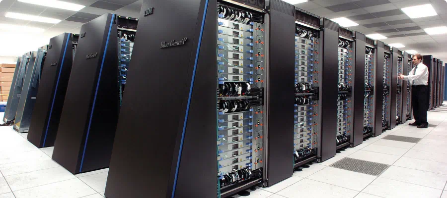
Data Processing
After acquiring the data in the field, we first validate it before we upload it to our high-speed computer processing centre. The data is then integrated into specialized software to be further processed to provide client-specific outputs.
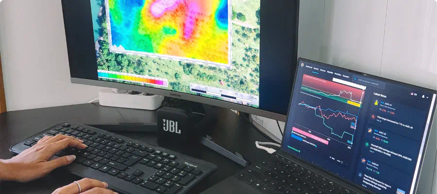
Data Analysis
Our experienced geophysical analysts not only carefully validate, process, and analyze the acquired data, but interpret and present it in clear, holistic, and transparent reports that are easy to understand so you can confidently make the right decisions.
What You can Expect from Enmintech
Comprehensive Turnkey Solutions for Your Entire Project
Professional Project Management and Execution
Dedicated Service focused on Results and Your Success
Experienced Team of Indonesian and Foreign Experts
State of the Art Technology and Survey Equipment
Outstanding Quality for a Reasonable Price
Quality Construction Services in Indonesia