Oil & Gas Projects in Indonesia
Enmintech provide a range of services to the Oil and Gas industry using the latest technologies combined with expert staff. UAVs combined with various cameras and sensors, allow fast, safe surveys for route planning, gas detection, asset inspection, and subsurface survey.
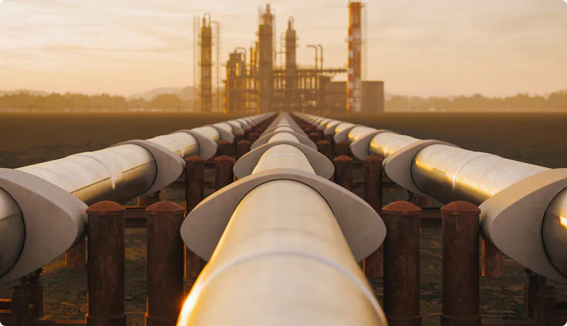
Oil & Gas Services
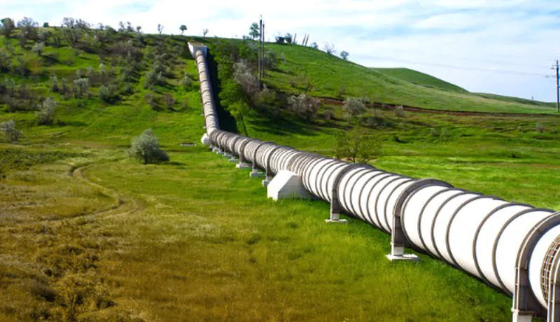
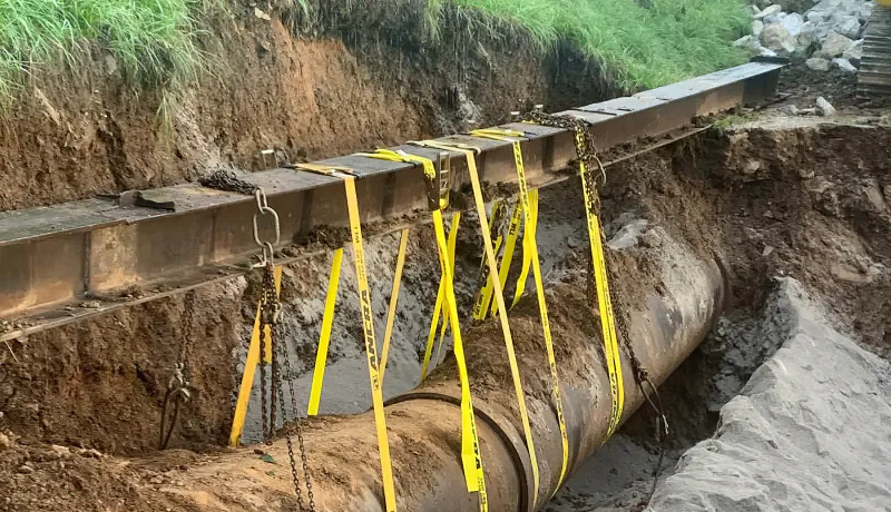
UAV Pipeline Inspection
UAV pipeline inspections provide many advantages over traditional methods. By reducing the need for human interaction, operators can improve safety, technical capability, and productivity while reducing costs.
Hi-Res Inspection Photos
Systematically inspect assets using high-resolution zoom cameras to obtain clear inspection photos of operational assets and high-risk structures.
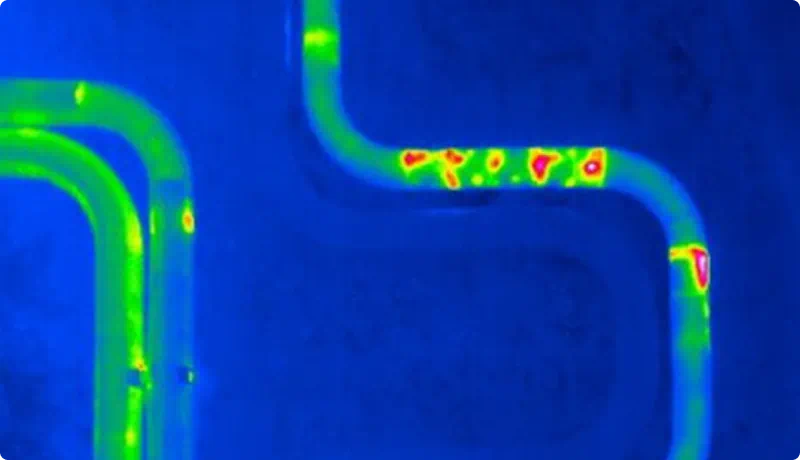
Thermal Infrared Imagery
By using a radiometric thermal camera, the detection of moisture-related problems, including water leaks, cracks, and corrosion, as well as friction-related problems, including fluid or gas congestion, and heat dispersion can be obtained.
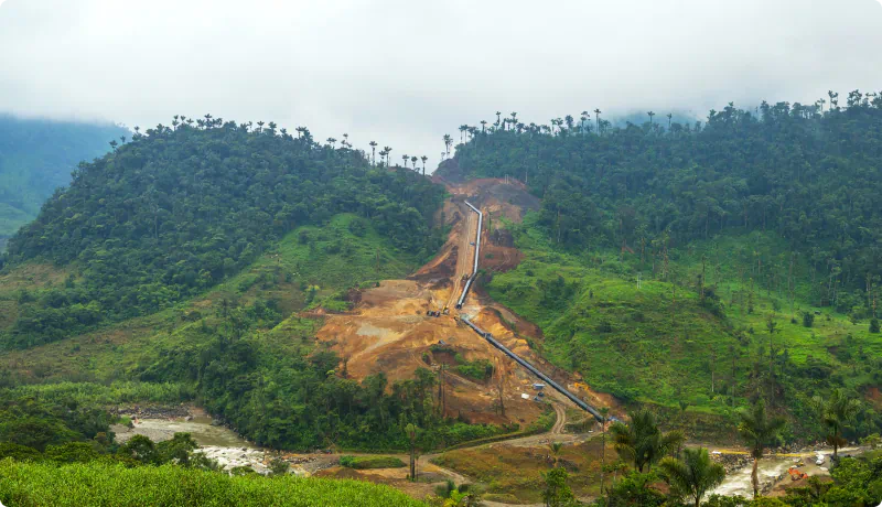
Route Planning
Potential routes for pipelines can be planned using UAV equipped with LiDAR and cameras. This will capture all the required detail for a complete understanding of the proposed pipeline route.
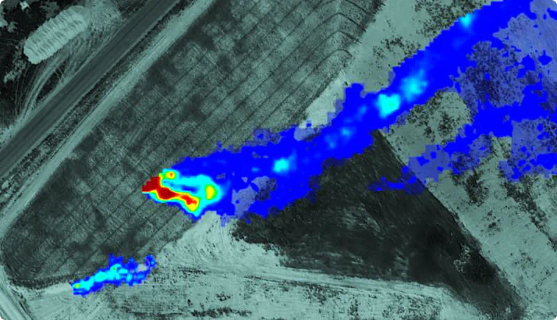
Gas Leak Detection
Gas detection sensors mounted on a UAV makes it possible to detect hazardous gas leaks and emissions from operational assets, and obtain detailed concentration analysis for all gas types including CH4, H2S, SO2, VOC, CxHx / LEL, CO, CO2 and PM 1.0 / 2.5 / 10.
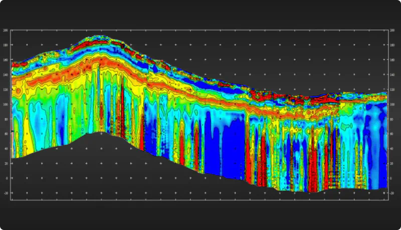
Geophysical Surveys
Once the final route is chosen a geophysical sub surface survey can be performed to detect subsurface ground conditions, buried objects, hydrographic features and bedrock, by using Passive Seismic HVSR and UAV High Definition Magnetics.
Ground Risk Management & Geotechnical
We partner with PT Ground Risk Management to provide a range of services in ground engineering for both existing and pre-feasibility mine sites. Services include: Geo-Hazard Mapping, Risk Assessments and Mitigation Advice, Geotechnical Risk Assessments, Safety Reviews and Earthworks Design Advice.
Oil & Gas Services
UAV Pipeline Inspection
UAV pipeline inspections provide many advantages over traditional methods. By reducing the need for human interaction, operators can improve safety, technical capability, and productivity while reducing costs.
Hi-Res Inspection Photos
Systematically inspect assets using high-resolution zoom cameras to obtain clear inspection photos of operational assets and high-risk structures.
Route Planning
Potential routes for pipelines can be planned using UAV equipped with LiDAR and cameras. This will capture all the required detail for a complete understanding of the proposed pipeline route.
Thermal Infrared Imagery
By using a radiometric thermal camera, the detection of moisture-related problems, including water leaks, cracks, and corrosion, as well as friction-related problems, including fluid or gas congestion, and heat dispersion can be obtained.
Gas Leak Detection
Gas detection sensors mounted on a UAV makes it possible to detect hazardous gas leaks and emissions from operational assets, and obtain detailed concentration analysis for all gas types including CH4, H2S, SO2, VOC, CxHx / LEL, CO, CO2 and PM 1.0 / 2.5 / 10.
Geophysical Surveys
Once the final route is chosen a geophysical sub surface survey can be performed to detect subsurface ground conditions, buried objects, hydrographic features and bedrock, by using Passive Seismic HVSR and UAV High Definition Magnetics.
Ground Risk Management & Geotechnical
We partner with PT Ground Risk Management to provide a range of services in ground engineering for both existing and pre-feasibility mine sites. Services include: Geo-Hazard Mapping, Risk Assessments and Mitigation Advice, Geotechnical Risk Assessments, Safety Reviews and Earthworks Design Advice.
Project Process

Project Planning
As part of our process staff personally engage with your team to discuss the project and the objectives. We then assemble the best team of expertise and technology to deliver a solution that meets expectations, on time, on budget.
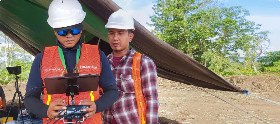
Project Execution
Our state-of-the art equipment is complex in nature and requires a deep understanding to be operated efficiently for getting best results. Our team of seasoned UAV pilots and expert surveyors from Indonesia and abroad are experienced in planning and executing challenging missions in dense jungles, steep terrain, or nearby airports.
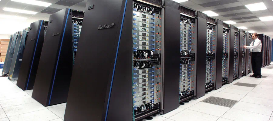
Data Processing
After acquiring the data in the field, we first validate it before we upload it to our high-speed computer processing centre. The data is then integrated into specialized software to be further processed to provide client-specific outputs.
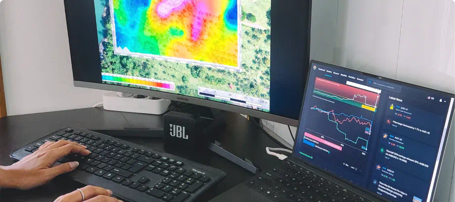
Data Analysis
Our experienced geophysical analysts not only carefully validate, process, and analyze the acquired data, but interpret and present it in clear, holistic, and transparent reports that are easy to understand so you can confidently make the right decisions.
What You can Expect from Enmintech
Comprehensive Turnkey Solutions for Your Entire Project
Professional Project Management and Execution
Dedicated Service focused on Results and Your Success
Experienced Team of Indonesian and Foreign Experts
State of the Art Technology and Survey Equipment
Outstanding Quality for a Reasonable Price
Quality Oil & Gas Services in Indonesia