Geophysical Services
Enmintech provides a range of geophysical surveys in cooperation with Intrepid Geophysics. Our team of geophysicists and surveyors is highly experienced in working throughout Indonesia using a variety of surveys — including UAV High Definition Magnetics and Radiometrics, Passive Seismic HVSR, Deep IP, and ERT — to discover what is hidden beneath the earth’s surface.
Geophysical Services
Enmintech provides a range of geophysical surveys in cooperation with AusThai Geophysical. Our team of geophysicists and surveyors is highly experienced in working throughout Indonesia using a variety of survey methods including: UAV High Definition Magnetics and Radiometrics, Passive Seismic HVSR, Deep IP, and ERT — to discover what is hidden beneath the earth’s surface.
Project Advice and Tailored Solutions

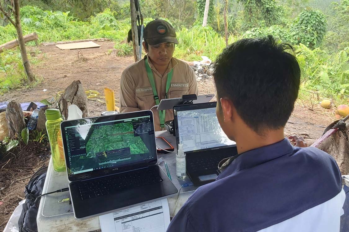
Every project has different requirements and requires specific applications of technology. Our team will meet with you to analyse and understand the project and your expectations. A plan is is then developed and discussed with you prior to implementation.
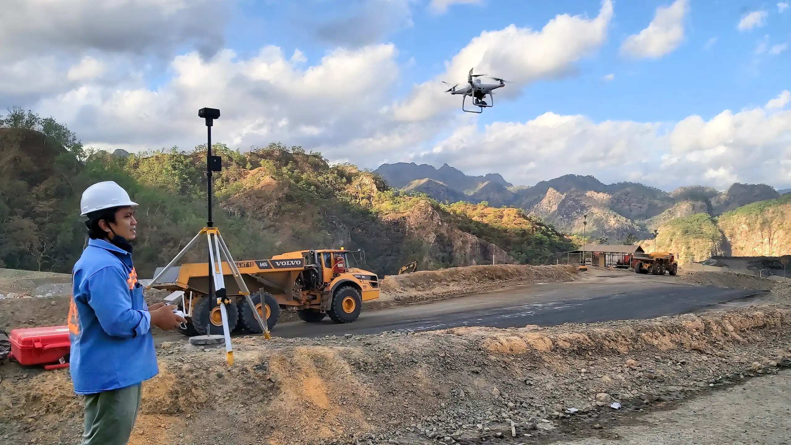
Drone High Resolution Magnetic Survey
UAV High Definition Magnetics is a new technique that uses a highly sensitive magnetometer mounted beneath a DJI M300. The UAV is carefully piloted to absorb the ground magnetics of the area of interest. Precision is essential to identify magnetic anomalies and each mission is checked for correct data acquisition and that magnetic lock has not been compromised. High Definition Magnetics provides detailed insights into geological structures and anomalies that can indicate mineral deposits.
Passive Seismic HVSR
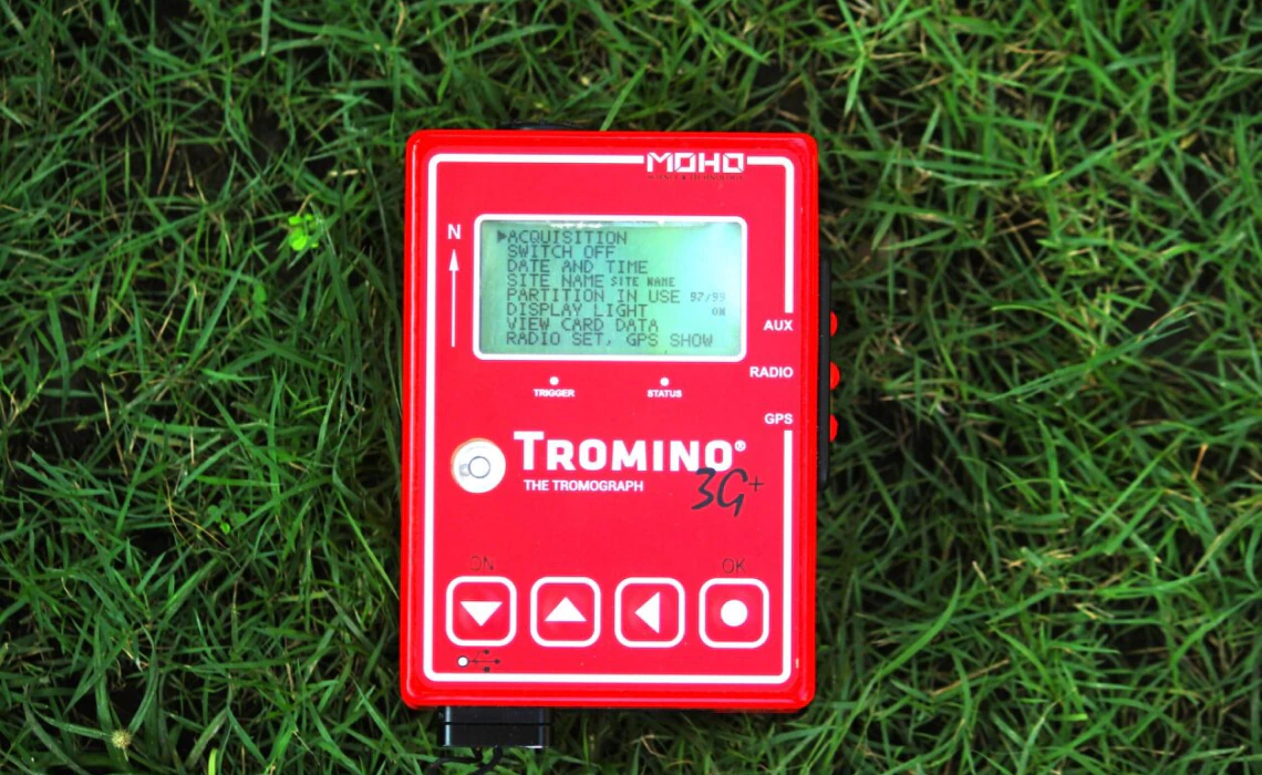
A new geophysical technique for discovering voids, stratigraphic layers, quartz veins, bedrock and aquifers. Relatively inexpensive, unobtrusive and fast passive seismic is helping geologists and engineers to define subsurface geology.
We use the world-leading TROMINO Passive HVSR receivers. The TROMINO is a self-contained instrument that weighs about 1kg and measures ambient seismic waves, commonly referred to as passive seismic, which are caused by wind, waves, and manmade vibrations, and is used for geological and engineering applications.
One of the most common applications for passive seismic is estimating the thickness of low velocity transported deposits, or highly weathered rock, sitting above higher velocity hard bedrock. This can be applied to paleo channel mapping for tin, nickel and alluvial mineral deposits, estimating cover thickness ahead of drilling programs, void and aquifer detection for environmental studies.
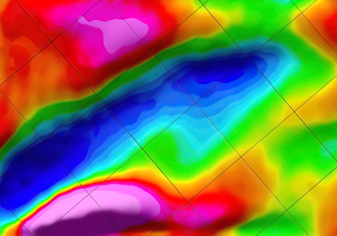
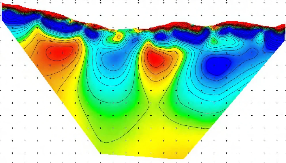
Deep Induced Polarisation
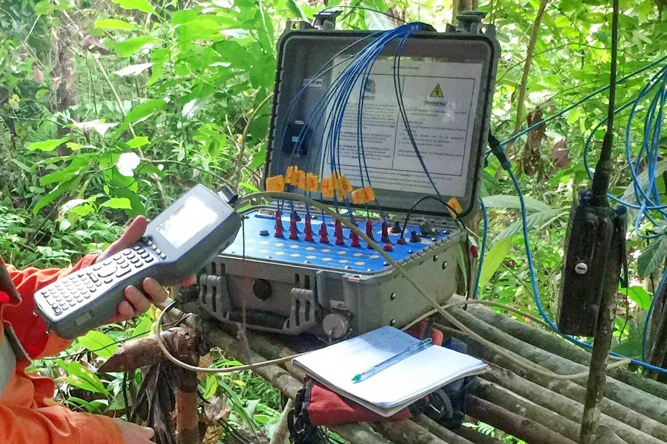
Deep IP is a technique for discovering deeply buried mineral deposits. The technique uses an array of sensors placed in a grid over the target area and then a range of alternating current frequencies are charged into the earth and measured.
The resulting data is then processed, analysed, and interpreted to identify targets for drilling. We have been particularly successful with this technique for identifying porphyry deposits in Indonesia up to 600m below the surface.
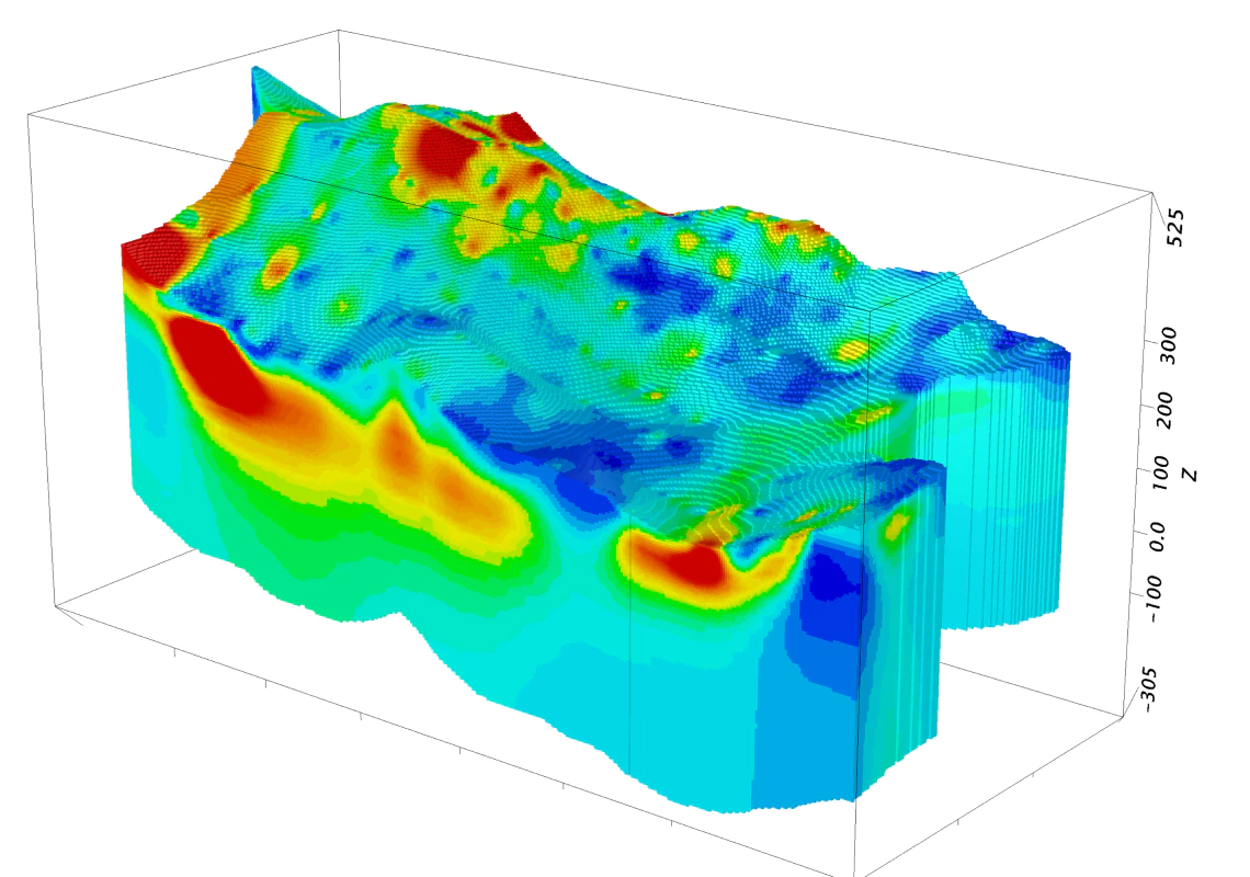
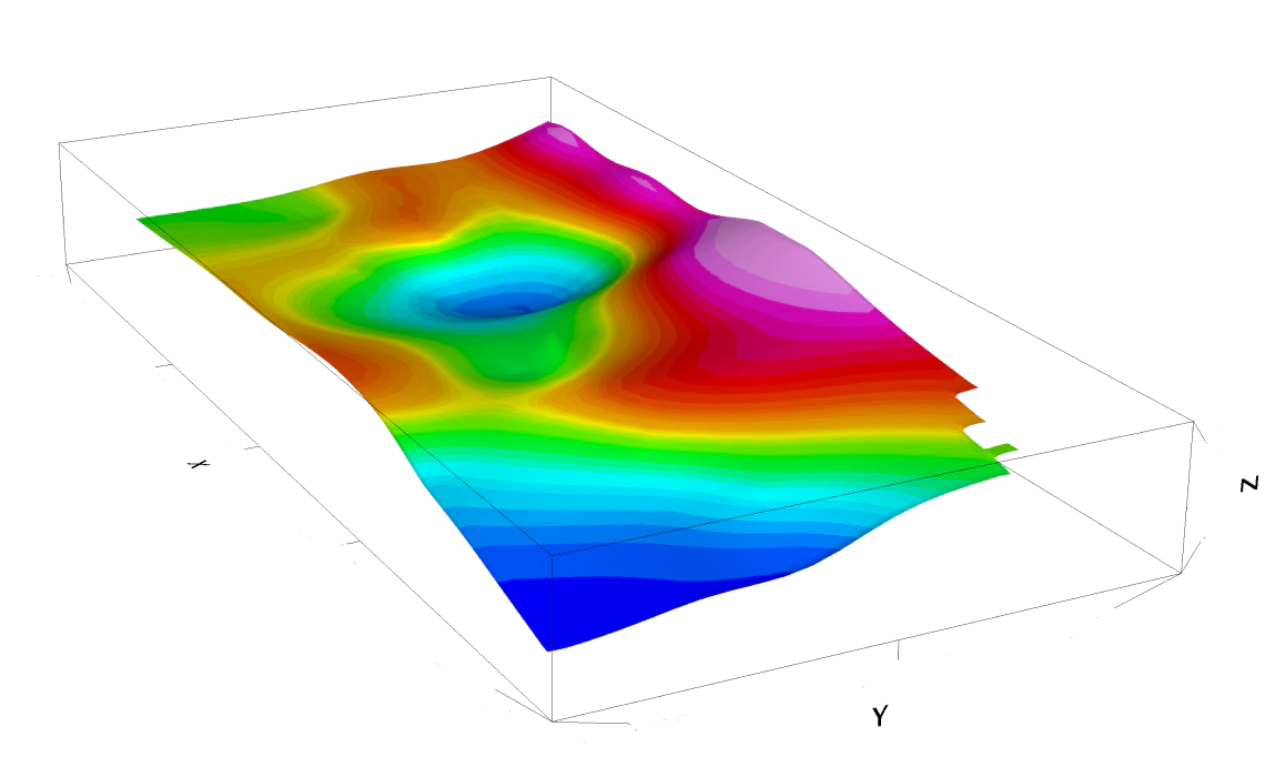
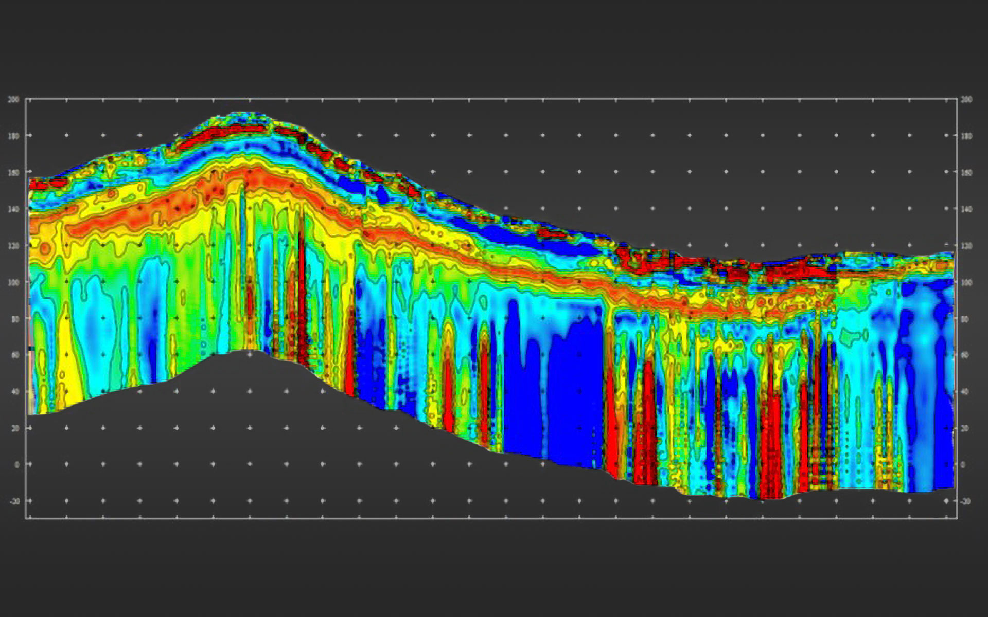
Electrical Resistivity Tomography (ERT)
Electrical Resistivity Tomography (ERT) is a geophysical technique used to image sub-surface structures and a well-consolidated method largely applied in near-surface geophysics. ERT determines the electrical resistivity of material through which an electric current is passed. The resistivity is a measure of the material’s ability to oppose the flow of electric current. ERT measurements can be performed along a linear surface transect, in a grid or non-linear geometry, as a vertical sounding, in a borehole, or from watercraft. The data are used to produce a 2D electrical image (a “cross section” or “plane”) or 3D distribution of subsurface resistivity values.
Quality Surveying Services in Indonesia