- Services
- Geophysical
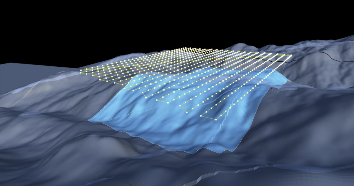
- Drone High Resolution Magnetic Survey
Drone High Resolution Magnetic Survey
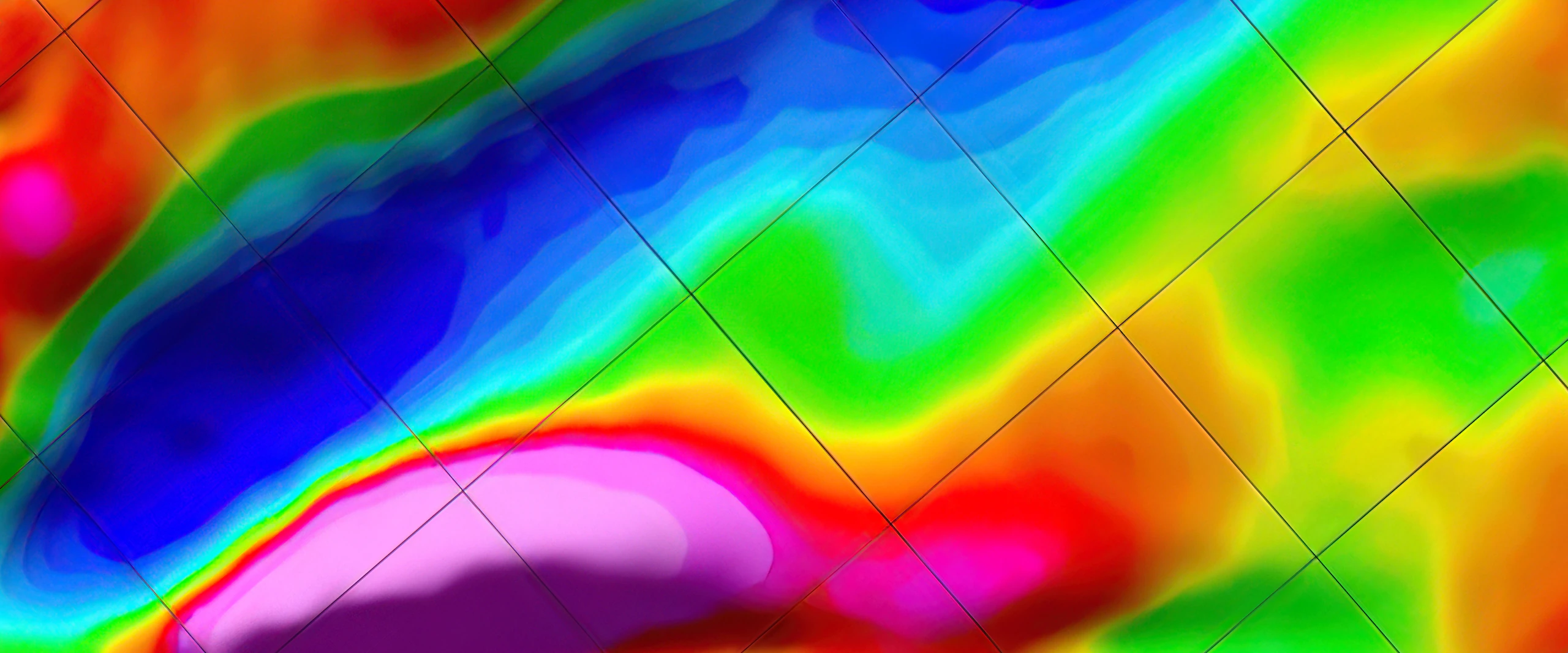
High Definition UAV Magnetics is a giant step forwards from traditional airborne magnetic surveys. The drone flies closer to the surface absorbing huge amounts of magnetic data to reveal structures and potential mineral deposits. The processed image resolution is 5 times clearer than traditional magnetic survey.
Drone High Resolution Magnetic Survey
High Definition UAV Magnetics is a giant step forwards from traditional airborne magnetic surveys. The drone flies closer to the surface absorbing huge amounts of magnetic data to reveal structures and potential mineral deposits. The processed image resolution is 5 times clearer than traditional magnetic survey.
Applications for High Resolution Magnetic Surveys
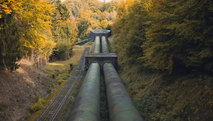
Oil & Gas Pipeline Inspection
High Definition Magnetics can be used to survey existing pipelines for detection of illegal taps and intrusive buried structures that can damage the pipeline.
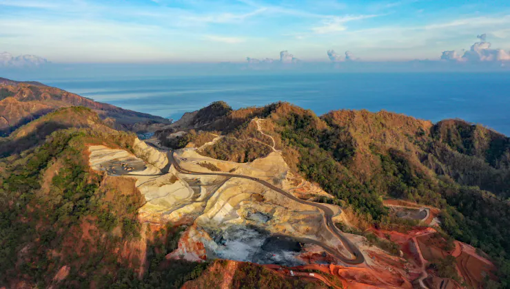
Mineral Exploration
High Resolution Magnetic Mapping is the most recent innovation for identifying mineral deposits. The resolution of imagery is 5 times better than traditional airborne surveys, and when combined with LiDAR and photographic thermal imagery, it provides the exploration team with a comprehensive data set.
Benefits of UAV High Definition Magnetics
High Accuracy
High definition magnetometers capture subtle variations in the earths magnetic field by flying close to the earths surface at a relatively slow speed compared to airborne magnetic surveys.
Fast Turnarounds
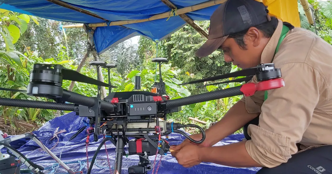
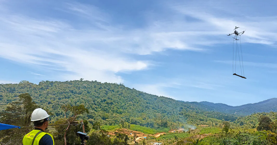
UAVs can be deployed quickly into remote areas of Indonesia. Our survey teams are highly experienced working in steep mountainous terrain and can carry out surveys quickly and efficiently.
Cost Effective
The use of drones for magnetic surveys offer significant savings compared to traditional airborne surveys, since clearances are fast, mobilisation and support is efficient and economical.
Real-time Data Acquisition
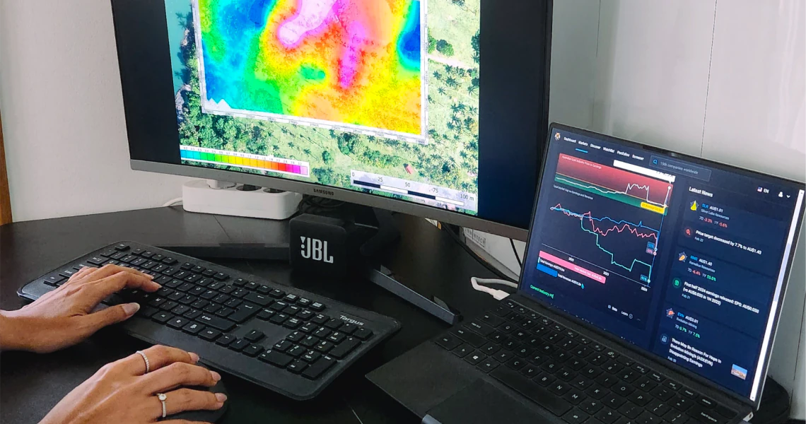
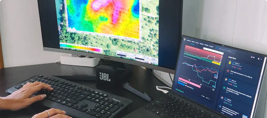
Data capture is performed carefully and quickly over the survey area. Initial on site processing can reveal anomalies that allow the geologist to expand or focus the survey on areas of interest.
Best for Challenging Terrain
Indonesia has challenging terrain with high topographic relief. Complex mission procedures combined with multiple technologies are followed to ensure the best possible results.
Data Integration
Magnetic surveys data can be integrated with other surveys, such as LiDAR and Orthophoto information, to provide a holistic data set that assists the geologist in the discovery of minerals.
High Accuracy
High definition magnetometers capture subtle variations in the earths magnetic field by flying close to the earths surface at a relatively slow speed compared to airborne magnetic surveys.
Fast Turnarounds
UAVs can be deployed quickly into remote areas of Indonesia. Our survey teams are highly experienced working in steep mountainous terrain and can carry out surveys quickly and efficiently.
Cost Effective
The use of drones for magnetic surveys offer significant savings compared to traditional airborne surveys, since clearances are fast, mobilisation and support is efficient and economical.
Real-time Data Acquisition
Data capture is performed carefully and quickly over the survey area. Initial on site processing can reveal anomalies that allow the geologist to expand or focus the survey on areas of interest.
Best for Challenging Terrain
Indonesia has challenging terrain with high topographic relief. Complex mission procedures combined with multiple technologies are followed to ensure the best possible results.
Data Integration
Magnetic surveys data can be integrated with other surveys, such as LiDAR and Orthophoto information, to provide a holistic data set that assists the geologist in the discovery of minerals.
UAV Magnetic Survey Process

1. Project Planning
2. Project Preparation
3. Preliminary UAV Survey
4. Magnetic Survey
5. Data Processing & Analysis
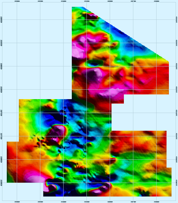
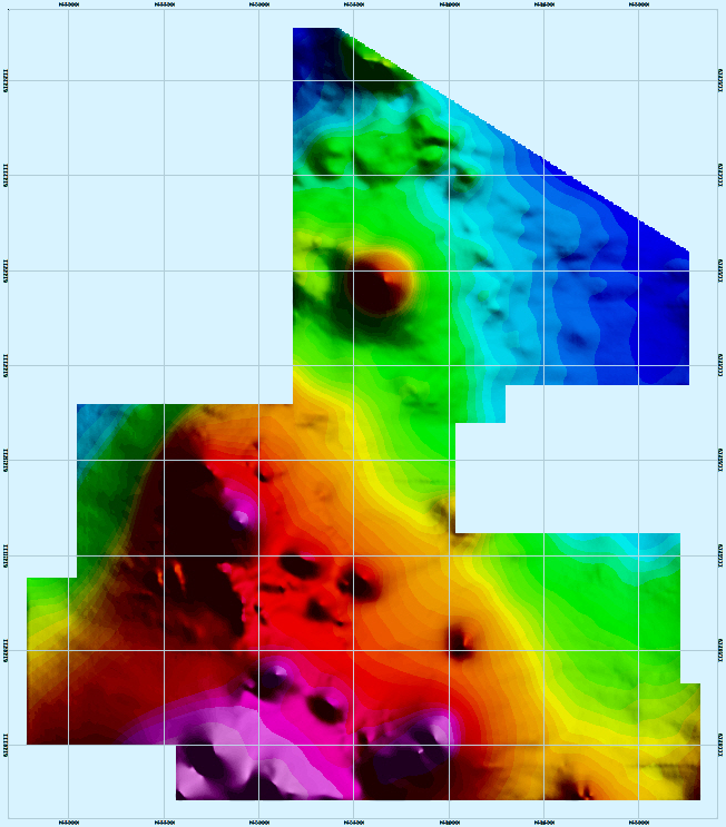
Flexible Visualisation of Magnetic Surveys
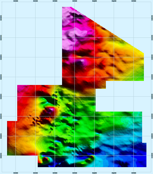
Total Magnetic Intensity (TMI)
Residual Magnetic Intensity (RMI)
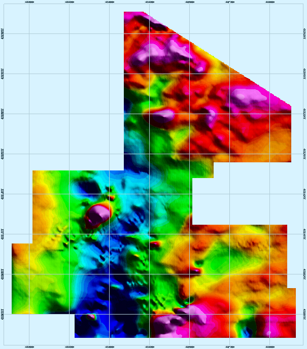
Reduction to the Pole (RTP)
Vertical Integral of Total Gradient (VIAS)
Our Technology and Expertise
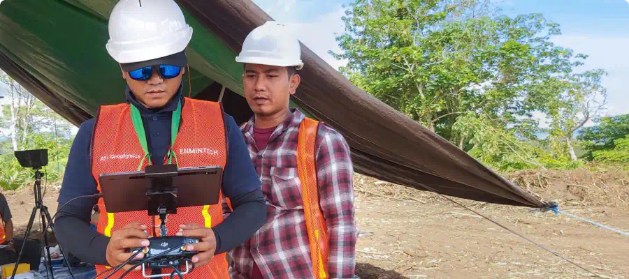
Expert Pilots and Surveyors

Geometrics MagArrow II
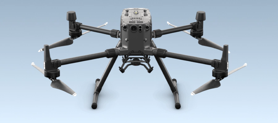
DJI Matrice 300 RTK
Expert Analysts
What You can Expect from Enmintech
Comprehensive Turnkey Solutions for Your Entire Project
Professional Project Management and Execution
Dedicated Service focused on Results and Your Success
Experienced Team of Indonesian and Foreign Experts
State of the Art Technology and Survey Equipment
Outstanding Quality for a Reasonable Price